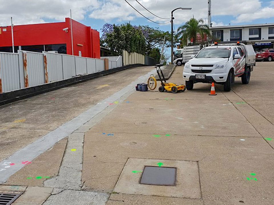
You’ve probably heard the word being thrown around but what exactly is GPR?
GPR stands for ground penetrating radar. Radar is short for radio detection, which is a technique that employs high frequency pulsed radio waves in order to acquire subsurface information. By utilising this technique, we are able to discover hidden metallic and non-metallic structures. GPR systems are typically comprised of three elements:
- An antenna
- Control unit
- Display storage device
HOW DOES GPR WORK?
Electromagnetic waves radiate from the transmitting antenna. Buried objects or boundaries cause part of the wave to bounce back to the receiver where they are digitised along the server line. That transmitter continuously emits electromagnetic impulses which propagate through the media and reflect back to the receiver. The control unit gathers the signals from the receivers and transfers them to the storage. The GPR technique involves some limitations however, such as conductive sources sometimes causing radar waves.
Antennas come in various frequencies depending upon your application. High frequencies are suitable for shallow depth and small targets (e.g. concrete applications), whilst low frequencies are typically used for deeper depths and larger targets (e.g. geological and archaeological applications).
ADVANTAGES OF GPR
Finding and mapping utility lines can often prove to be more of a challenge than most initially expect. Drawings may be outdated, historic records could be misplaces, and the move from analogue to digital has further complicated archives. Adopting GPR methods help ease the pain associated with destroying live lines or wires. The number one advantage associated with GPR, is the ability to avoid excavating in order to discover utilities. The need for unnecessary digging and disturbance is overcome completely. A GPR survey in the early stages of a construction project can identify utilities and underground structures which create a guide of where contractors are able to dig.
DATA PROCESSING
Transmitted electromagnetic pulses are digitised and recorded as waveforms. Ontop of the waveforms, the reflections deeper within the surface are displayed as a wiggle trace, recorded side by side. As the antenna is pulled accross the surface, the amplitude of the waveforms are typically color-coded, often within a 256 colour scheme where the positive amplitudes show as brighter versions in comparison to the negative amplitudes. When displayed in colour, they’re known as line scans. This data can then be translated into 3D images and drawings once transferred to a CAD specialist. From there, the drawings are used to establish where underground services exist, and where contractors are safely able to dig.
LIMITATIONS OF GPR
A GPR’s effectiveness is site specific and will vary greatly from location to location. Depth can be accurately identified in most cases, however a pipe diameter to depth ratio needs to be utilised as a guideline for what users can expect to see. The major downfall of GPR technology is that areas with highly-conductive materials (i.e. clay soils and salt contaminated soils). Performance can also greatly be limited by signal scattering in heterogeneous conditions (i.e. rocky soils), and will respond to changes in soil type, density, water content, and the addition of buried objects. GPR is equally unable to see through metal plates, fine metal mesh, and pan decking. In order to overcome these limitations, GPR technology is often complemented with EM locator technology.
WHAT IS AN EM LOCATOR?
EM which stands for electromagnetic is a type of locator technology which relies upon the detection of an alternating magnetic field. This magnetic field is created by a flow of current through a conductor. Often, additional ‘tracer wires’ are run parallel to non-conductive pipes for detection of gas lines. Power lines typically radiate an easily detectable magnetic field as a sign of normal operation.
ELECTROMAGNETIC INDUCTION EXPLAINED
To better understand how an EM locator works, you’ll need to know the basics of electromagnetic induction. Electromagnetic induction is the ability to create a current inside of a conductor. Famous physicist Hans Christian Ørsted discovered that the current in a wire creates a magnetic field which can affect a compass needle (essentially a small magnet), and so can produce magnetic fields.
WHY DYNAMIC HYDRO EXCAVATIONS?
Dynamic Hydro Excavations are proud to be a leader in providing outsourced utility location services that accurately detect underground utilities, cables and pipes, electrical services, water lines, and more. Through the use of the latest technology, our location services team are able to ensure a safe, seamless construction project. Our dedicated team work seamlessly in conjunction with both external surveyors and GPS plotting technology.
Sources:


